Drone photography in Charleston, SC
FAA Part 107 certified drone photos and aerial video for Charleston listings, lots and new communities. Flown by certified pilots and planned around Charleston's airspace, the light and the tide.
Book your shoot →In Charleston, the setting is half the listing.
A marsh view off the back porch. A dock on the Wando or the Stono. A fairway on Daniel Island, a walk to the beach on Sullivan's or Folly, a quiet lot on Johns Island. None of that shows up in a photo taken from the driveway. A drone shows buyers exactly what they're getting and where it sits before they ever book a showing.
We were Realtors in this market before we ever picked up a drone, so we fly for what sells the house: the water, the lot, the neighborhood and the route to everything a buyer cares about.
Recent aerials.
A few recent stills from around the area.


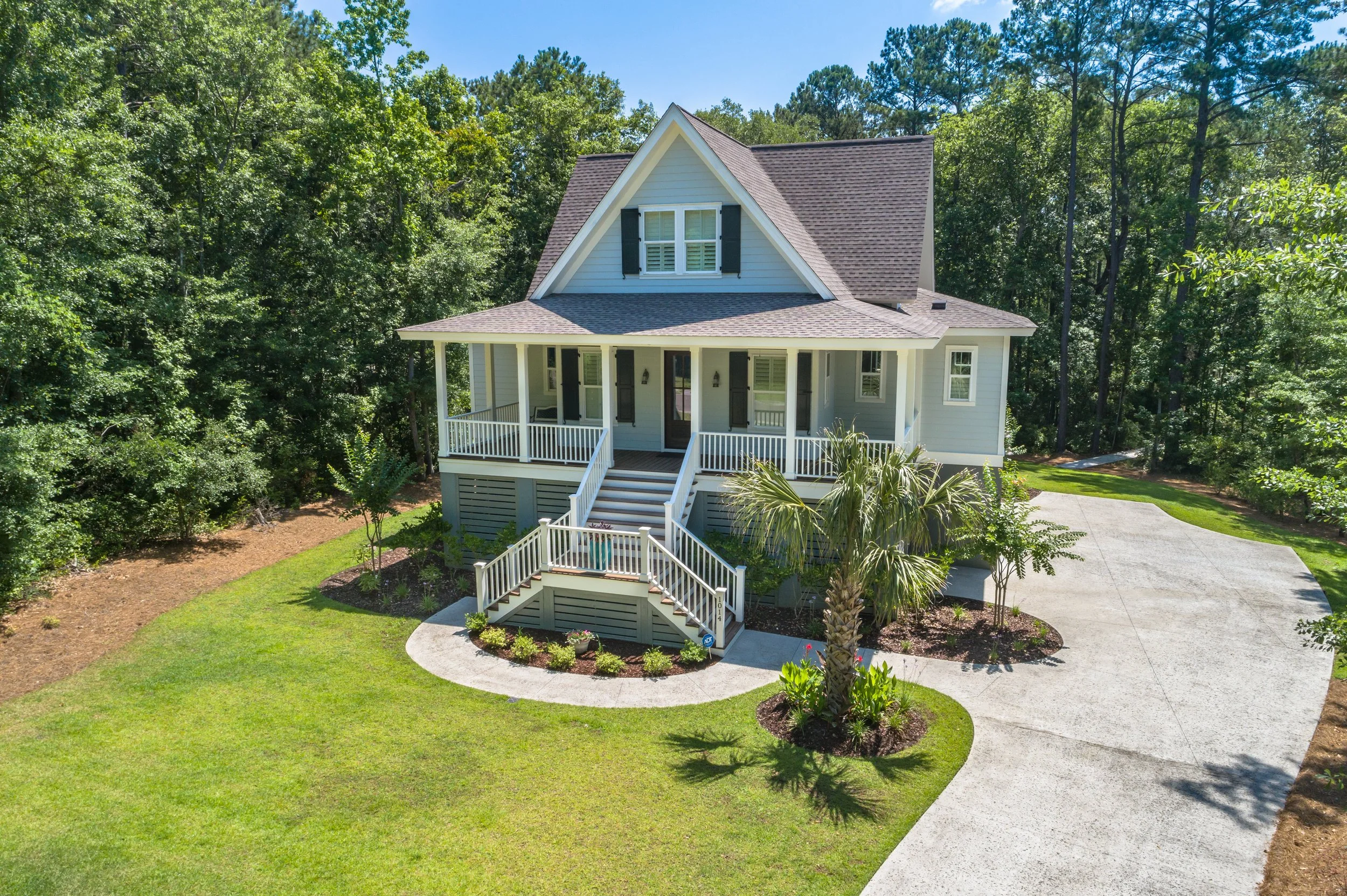
What a drone shoot looks like here.
A few jobs from this year, so you know what you're booking.
A marsh lot, flown low
Three quarters of an acre on the marsh. The brief was low drone video across the marsh toward the house so buyers feel the view, plus higher shots to show the whole lot and where it sits.
Land with aerial video
A land listing where the drone told the story. Aerial stills for the MLS plus a listing video, so buyers could see the property and the setting around it before making the drive.
Marking the property on the aerials
The listing agent wanted buyers to see exactly which lot was for sale. Our pilot added arrows to the aerials, and with the plat in hand we can draw the lot lines too.
Industrial space for a national firm
Ground photography and aerial stills of an industrial building for a commercial real estate firm based out of state. Same crew, same booking process as a home listing.
We handle the airspace before we show up.
Charleston is one of the trickier places in South Carolina to fly a drone legally. A lot of the area sits under busy, controlled airspace, and hobby pilots get this wrong all the time. That's your listing and your seller on the line.
- Charleston International and Joint Base Charleston share busy Class C airspace over North Charleston, with airline, cargo and military traffic. Flights inside it need FAA authorization before takeoff.
- Charleston Executive Airport on Johns Island and Mount Pleasant Regional bring their own traffic to the islands and north Mount Pleasant.
- Helicopters fly low here. Tours work the harbor near the Yorktown, and the hospital helipads downtown and in Mount Pleasant see traffic at any hour.
Before every flight our pilot checks the airspace for that address and requests authorization when it's required, so the shoot doesn't get scrubbed in your seller's driveway. Every flight is by an FAA Part 107 certified, fully insured remote pilot.
Every angle that matters.
Elevated front exteriors
The hero shot, from just high enough to show the home and its grounds together.
Lot lines & boundaries
Acreage, frontage and where the property begins and ends, marked on the photo.
Water, marsh & docks
Creek access, dock placement, marsh views and the run to open water.
Neighborhood context
The beach, the golf course, the pool, downtown. Show buyers how close it all is.
Cinematic aerial video
Smooth reveals that open on the setting and push in on the home, cut for MLS and social.
Communities & amenities
Builders and HOAs: clubhouses, pools, trails and phases from above.
What drone costs in Charleston.
Same pricing in Charleston and Greenville, no upcharge for rentals or commercial, and Pay at Close is available.
Essential package
Professional photography, aerial drone photos, virtual twilight and the Marketing Kit. Drone is included in every package.
Premier package
Adds cinematic interior video, cinematic aerial video, a 3D tour and a floor plan to everything in Essential.
Lots & land aerials
Drone coverage on its own for raw lots and acreage, with property lines when you have the plat.
See every option on the pricing page, or book online any time.
Drone photography across the Charleston area.
New to aerials? Read our guide to drone photography for Charleston real estate. Shooting in the Upstate? See Greenville drone photography.
Give Charleston buyers
the view from above.
Book online in under two minutes. Fast turnaround, Marketing Kit included, and Pay at Close available.
Book an appointment →